...FREEZE WATCH IN EFFECT FROM LATE MONDAY NIGHT THROUGH TUESDAY
MORNING...

* WHAT...Sub-freezing temperatures as low as 25 possible.

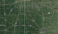
* WHERE...All of central Indiana.

* WHEN...From late Monday night through Tuesday morning.

* IMPACTS...Frost and freeze conditions could kill crops, other
sensitive vegetation.

PRECAUTIONARY/PREPAREDNESS ACTIONS...

Take steps now to protect tender plants from the cold.

&&
...The Flood Warning continues for the following river and locations
in Indiana...Illinois...

Wabash River at Clinton, Covington, Lafayette, Montezuma,
Vincennes, Mount Carmel, and Riverton.

...The Flood Warning is extended for the following river and
locations in Illinois...Indiana...

Wabash River at Hutsonville Legacy Power Plant Site, and Terre
Haute.

.Widespread and significant flooding is in progress.  Rains of four
to over six inches has fallen.

PRECAUTIONARY/PREPAREDNESS ACTIONS...

To escape rising water, take the shortest path to higher ground.

Please report observed flooding to local emergency services or law
enforcement and request they pass this information to the National
Weather Service when you can do so safely.

Additional information is available at www.weather.gov/ind.

The next statement should be issued Sunday afternoon by around 300
PM EDT /200 PM CDT/.

&&

...FLOOD WARNING NOW IN EFFECT UNTIL THURSDAY MORNING...

* WHAT...Minor flooding is occurring and minor flooding is forecast.

* WHERE...Wabash River at Lafayette.

* WHEN...Until Thursday morning.

* IMPACTS...At 17.0 feet, Lowland flooding in progress. Flood waters
close SR 225 just south of the Wabash River near Battleground.
Walking and bike trails in Tapawingo Park area are flooded. Warren
CR 350 N in the Black Rock Preserve area flooded. Flood waters
near Tippecanoe CR 950 W south of CR 75 S.

* ADDITIONAL DETAILS...
- At 9:30 PM EDT Saturday the stage was 14.7 feet.
- Recent Activity...The maximum river stage in the 24 hours
ending at 9:30 PM EDT Saturday was 14.7 feet.
- Forecast...The river is expected to rise to a crest of 16.8
feet tomorrow evening. It will then fall below flood stage
Wednesday evening.
- Flood stage is 11.0 feet.
- http://www.weather.gov/safety/flood

&&
...The Flood Warning continues for the following waterways in
Indiana...

Big Raccoon Creek near Fincastle.

Haw Creek near Clifford.

Big Walnut Creek near Reelsville.

Big Blue River at Carthage.

Buck Creek at Acton.

Sugar Creek at New Palestine and near Edinburgh.

Mill Creek near Cataract.

Clifty Creek at Hartsville.

Wildcat Creek at Kokomo and near Jerome.

Mississinewa River near Ridgeville.

Youngs Creek at Amity.

...The Flood Warning is extended for the following rivers in
Indiana...

Flatrock River at Saint Paul and near Columbus.

Big Blue River at Shelbyville

Driftwood River near Edinburgh.

Fall Creek near Fortville and Millersville.

Wildcat Creek near Lafayette.

Eel River at Bowling Green.

...The Flood Warning is cancelled for the following rivers in
Indiana...

White Lick Creek at Mooresville.

Muscatatuck River at Vernon.

.Widespread and significant flooding is in progress.  Rains of four
to over six inches has fallen.

PRECAUTIONARY/PREPAREDNESS ACTIONS...

To escape rising water, take the shortest path to higher ground.

Please report observed flooding to local emergency services or law
enforcement and request they pass this information to the National
Weather Service when you can do so safely.

Additional information is available at www.weather.gov/ind.

The next statement should be issued this evening by around 1145 PM
EDT.

&&

...FLOOD WARNING NOW IN EFFECT UNTIL EARLY TUESDAY MORNING...

* WHAT...Minor flooding is forecast.

* WHERE...Wildcat Creek near Lafayette.

* WHEN...Until early Tuesday morning.

* IMPACTS...At 10.0 feet, Flooding of lowland areas in progress in
portions of Tippecanoe County.

* ADDITIONAL DETAILS...
- At 2:45 AM EDT Saturday the stage was 7.5 feet.
- Forecast...The river is expected to rise above flood stage
late this evening to a crest of 11.7 feet tomorrow evening.
It will then fall below flood stage late Monday evening.
- Flood stage is 10.0 feet.
- http://www.weather.gov/safety/flood

&&


